Sycamore Grove Hike & Hoot Owl Recap | October 17th

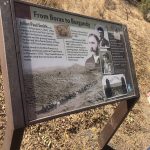
On Sunday, October 17th, starting at 1 pm, the Pack 104 Webelos den 2 led a hike at the Sycamore Grove Trail. This moderately trafficked 4.8 mile loop trail is located near Livermore, California. The trail is primarily used for hiking, walking, nature trips, and bird watching and is best used from May until October.

This was an excellent alternate to the Flag Hill hike for the youngest Scouts or novice hikers, with only 200 feet of elevation gain.

After the Sycamore Grove hike, the Webelos den had a quick dinner and completed the Hoot Owl night hike. This is one of the hikes in the Trail Trekkers series, and perhaps the most unique of all. A park ranger led the group on a 1-1.5 mile night hike to look for owls and signs of owls within Sycamore Grove Park.

Photos from this day:

Hike Statistics
Starting point: parking lot
Distance: 4.8
Time: Allow about 3-4 hours
Grade: Easy
Suggested age: Tigers through Webelos Suggested Season: Year round

Sycamore Grove Trail Map: https://drive.google.com/open?id=1dfHNSGwONPgaPQFhIC67VPp-khE7wiBN

Pack 104 Cub Scouts Serving their Community!! October 16

On Saturday, October 16th, Cubs from Pack 104 descended on several local school sites to clean up litter and other debris around the entranceways, parking lots, and street fronts.

In addition to visiting Harding Elementary School Fairmont Elementary School Madera Elementary School and Mira Vista Elementary School, they also managed to stop by and clean up around the El Cerrito Library and part of Upper Canyon Trail park.

Over the course of the morning, 31 volunteers from the Pack put in more than 60 hours of service.

Three cheers for the hardworking Scouts of Pack 104! Makes me a proud mom and happy to continue to be a part of this dynamic and helpful community-based group. #teamwork #serving #community #cleanup #localschools #pack104

Pack 104 Connects with Scouts in Chiba, Japan | October 16

Roy Adam (Chartered Organization Representative), organized a fun, unique opportunity for Pack 104 Scouts to connect with Scouts who live in Chiba, Japan. This happened on Saturday, October 16, at 6 PM PST (10 am JST) via Zoom!

The Scouts had a great cultural exchange and an open Q&A period, talking for about an hour in total. Overall they had a fun time sharing their interests, hobbies, and details on their food / diet.

This was be part of JOTA/JOTI and the scouts who participated all earned a patch for taking part in the activity. See gallery below for a few photos from the event.

The Jamboree on the air patch that they earned looks like this:

Thanks again, Roy, for coordinating this exchange.

Pack 104 Hike up Flag Hill Recap | October 9

Pack 104 Webelo den organized a moderately strenuous pack hike in the Sunol Regional Wilderness in California on October 9th. The hike consisted of a 3.9 mile loop trail and boasts a short, steep climb up Flag Hill with 994 feet of elevation gain.

There were two scouts from the Webelo den who attended this hike with their parents. Here is a photograph of a skull that was observed on the pathway during the hike.

Hike Statistics
Starting point: Visitor center / parking lot Distance: 3.5
Time: Allow about 3 hours
Grade: Moderate
Suggested age: Bears, Webelos

Suggested Season: Fall, spring, summer.

Hike Description
Begin this hike by crossing Alameda Creek on the footbridge near park headquarters. Turn left (downstream). After a short distance, Flag Hill Trial will take off uphill, to the right. The trail zigzags up the face of the hill (make sure your hikers understand why it’s important not to shortcut switchbacks). After about a mile of rather steep uphill hiking, you’ll reach the top where you’ll probably want to take a good snack or lunch break. While on top, watch for red-tailed hawks (the red upper surface of the tail is visible when the hawk turns), turkey vultures (which hold their wings in a slight “V” and teeter in flight), and maybe even a golden eagle or falcon.
Continue your hike by dropping down the back side of Flag Hill, turning right when you reach High Valley Road. Return to the cars by way of Hayfield Road.

Trail map: https://www.alltrails.com/explore/trail/us/california/flag-hill-loop-trail?mobileMap=false&ref=sidebar-static-map